

Key Points
Andover’s Shawsheen River Masterplan makes several important points with regard to the current Haggetts Pond asphalt paved multi-use plan:
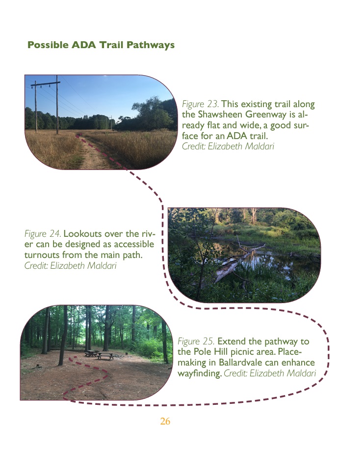
- The Shawsheen River bank and Pomps Pond offer opportunities to build ADA compliant trails due to the low grading and access to (See pg. 26 in ADA & Accessibility on the Shawsheen River )
- Boadwalks are preferable; pavement was considered the worst option because of its short life and hardness, which is challenging to those with low vision or sensitive to impacts (pg. 28 in ADA & Accessibility on the Shawsheen River)
- The environs already provide wide open spaces which would result in less loss of trees
- Moreover, the two sites offer the opportunity to connect Andover, Tewksbury, and River St.
- Finally, these sites are not adjacent to our town’s water supply or traversing Priority 1 parts of the Watershed Protection Overlay District
DOcuments
ADA Accessible alternatives to converting the Haggetts Pond rail trail until an asphalt paved multi-use path
Pomps Pond Alternative Plan
The Pomps Pond area provides a perfect location for an asphalt paved path with scenic views, generally low grades and of course no proximity to our drinking water supply or sensitive wetlands. Because the Pomps trail does not traverse wetlands, there are no culverts so implementation would be easier and less expensive.
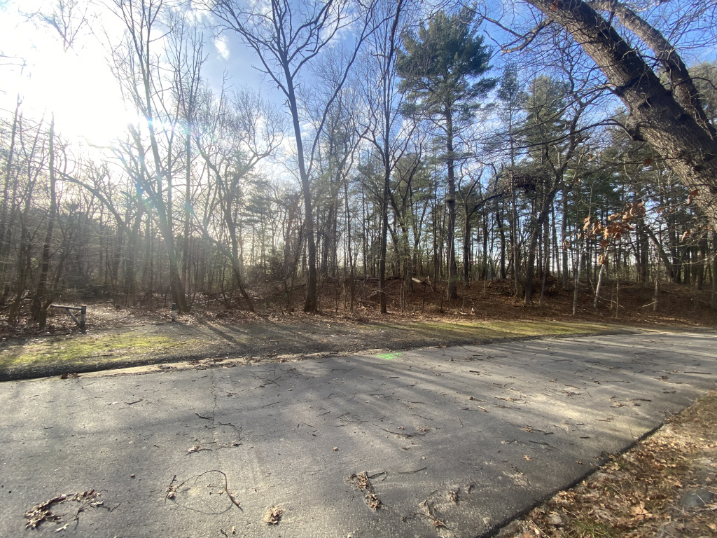
Parking Area
- Open 123’ x 20’ area could fits no less than 14 parking spaces
- including 2 van accessible parking spaces
- Requirements = minimum 8’ wide, 5’ approach area
- Already flat, crushed stone – adjacent to paved access road to beach
- Beach parking area can accommodate bus turn around and additional parking
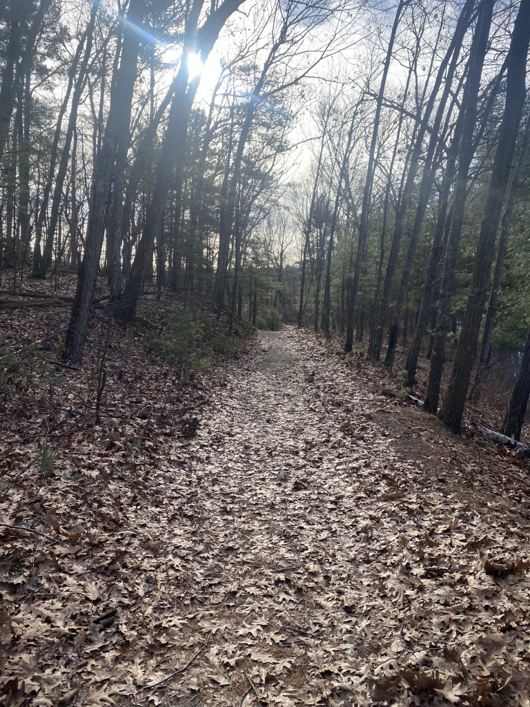
The Trail
- Accommodate an 8’ wide paved trail in most places without removing trees
- Relatively flat with less than 72” of elevation gain over more than a ½ mile
- Average of .2% slope
- No part of trail that would even come close to an 8.33% grade
- ADA slope compliance because slopes of up to 5% are acceptable throughout with up to 8.33% for no more than 30% of any trail considered ADA complient
- 0.5 mile long to turn around area, turn around circle = 0.2 mile
- Connector trail to Ballardvale could add additional 1/3 mile
Benefits in comparison to Haggett;s Pond Trail
- Not directly connected to the Town’s drinking water supply
- No culverts
- No abutting residents to any part of the trail
- Minimal wetland area – one creek crossing that a short wooden bridge can span
- No required street crossing
- No flashing lights, signs, crosswalks
- There is no need for drainage remediation measures
- About 500’ of Haggetts Pond Trail would require this additional expense
- It is not an NHESP Priority Habitat for Rare Species
- Lookout area for wide deck
- Already an existing access road for construction vehicles
- Dramatically less expensive
Additional Benefits
- Other activities – possible ADA accessibility to beach area
- Expanding access to the recreation facilities.
- Open area at the end of the trail can accommodate a large picnic area or open air
pavilion.
Existing access road
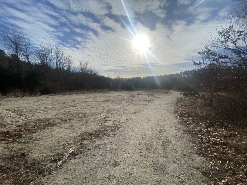
Open area suitable to develop new accessible parking spaces
Existing hard packed surface that can accommodate 8′ wide trail
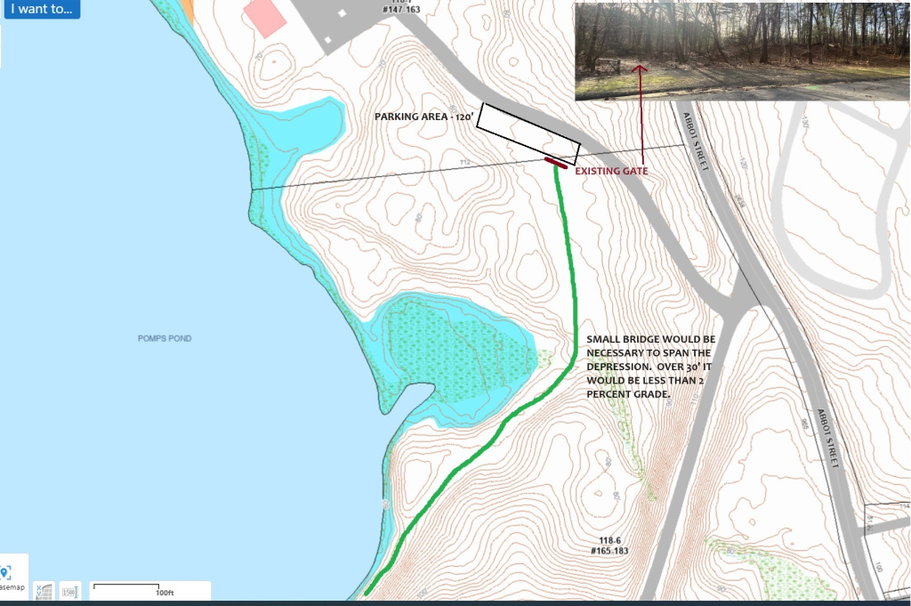
Topographical map of Pomps Pond trail showing low grade / minimal altitude gain
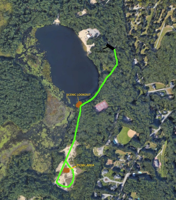
Path stretches through woodlands and along the pond with water views